West Antarctica
This place used to be desolate, now it's the heartbeat of civilisationWest Antarctica is a temperate continent at the South Pole. It was previously covered with a large ice sheet, but this has since melted to reveal the landscape beneath. In 2069, an alien race known as the Keln invaded Earth and conquered the region. At the same time as the invasion, climate change was having devastating effects on Earth. This area is one of the few suitable places for humans to live and its capital city Berkner has developed into a sprawling metropolis. West Antarctica is now the most populated continent on Earth, far surpassing the other habitable locations of Northern Canada, Europe and New Zealand.
Geography
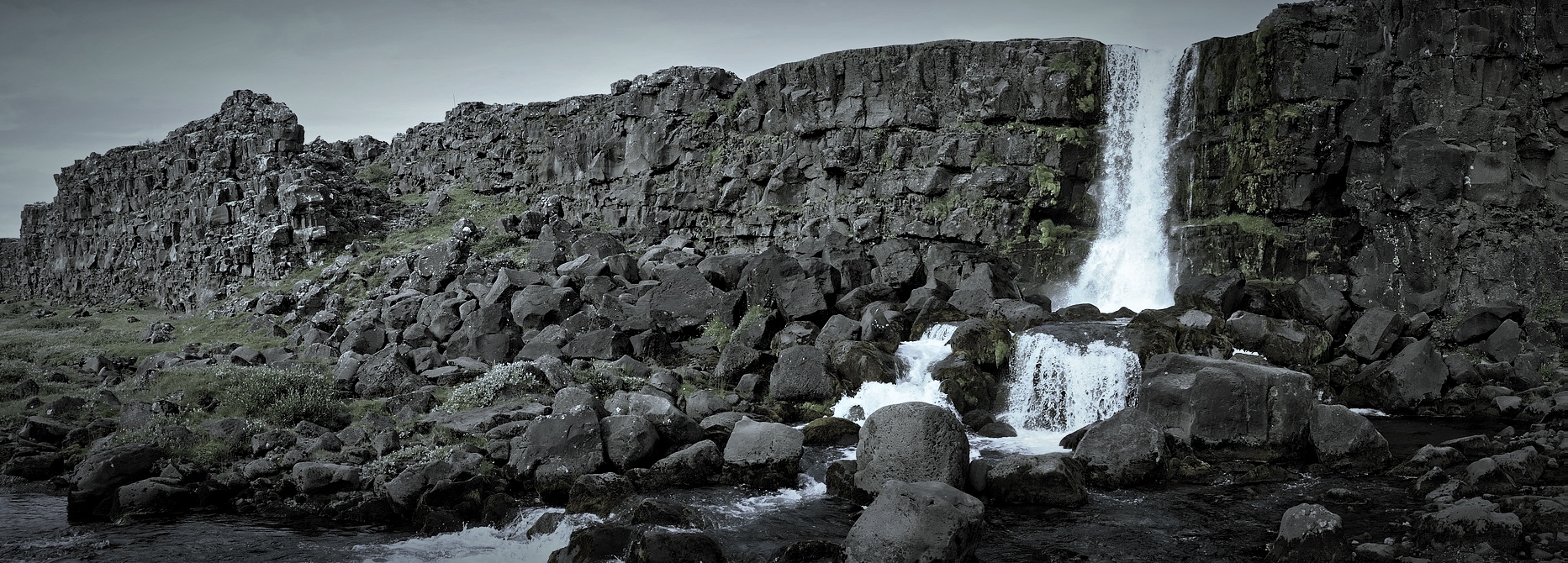
West Antarctica is far more than the desolate expanse of ice that it once was. As the ice sheet eventually melted, it revealed a complex landscape of mountains, gorges and rolling hills. The majority of West Antarctica is rocky and mountainous, making it difficult to build on. The urban area of West Antarctica is mostly within the flatter land, as it is easier to build on and closer to the sea.
It lies amidst the Ross Sea and the Weddell Sea, both of which were originally mostly ice shelves. It also borders the Transantarctic mountains, which separate the continent from Eastern Antarctica - which remains quite icy despite the climate change.
Regions
Palmer
Palmer is the southern half of the Antarctic Peninsula. It's the land closest to sea level, with some mountainous terrain to the centre. It contains the Elban Peaks and the Alderban rock. Palmer was named after Captain Nathaniel B.Palmer - who explored the area in 1820.Graham
Graham is the northern half of the Antarctic Peninsula. It contains a series of plateaus and a mountain - Mount Brading. Graham was one of the few areas to not have any ice on it prior to the melting of the ice sheet. It contains a few scientific bases from the past. Graham was named after Sir James R. G. Graham - First Lord of the Admiralty when John Biscoe was exploring the area in 1832.Ellsworth
Ellsworth is the area of land in the upper half of West Antarctica. It was named after the polar explorer Lincoln Ellsworth, who flew over the area in 1935 and discovered the Ellsworth mountains.Marie Byrd
Marie Byrd is the largest region in West Antarctica. It is located in the southern half of the continent and has the most mountainous terrain in the continent. It was named after the wife of Admiral Richard E. Byrd - who explored the area.Transantarctic Mountains
The Transantarctic Mountains are what separates West Antarctica from East Antarctica. It is one of the longest mountain ranges on Earth with a length of 3500km. Its highest point is Mount Kirkpatrick at 4,528 m. They were first sighted by James Clark Ross in 1841.
Fauna & Flora
There is not much natural flora or fauna in West Antarctica at the moment.
It was previously inhabited by several types of penguin, such as the Emperor and Rockhopper, as well as a few types of birds - such as the Snow Petrel. Alongside this, there were also several microscopic creatures that used to live in the area - such as nematodes and tardigrades. The significant climate change has turned all of this on its head. The populations of the penguins and snow petrels are now rapidly decreasing as they struggle to adapt to the changing temperatures.
But, new types of fauna are being introduced. The first colonisers that were sent to begin the construction of Berkner brought several types of animal with them in the hopes that they would survive in the now warmer climate.
Natural Resources
The largest downside to the development of West Antarctica is the sheer lack of resources. There is a small amount of minerals, such as coal, iron ore and gold, but these are in quantities too small to bother extracting. There is also several large oil deposits, but these have proven difficult to extract due to the lack of tools available.
The only major resource that can be found is ice. The ice that remains on the continent makes up a vast deposit of freshwater, perfect for supplying the water demands of the cities in West Antarctica.
However, as part of the colonisation process, a large amount of agricultural land was designated. There are now the beginnings of expansive farms in the area, growing enough crops to feed the population of West Antarctica. Farm animals were also brought along to the area, such as cows and pigs. Finally, there are fairly large amounts of fish to be caught off the coast on the Antarctic Peninsula.
Maps
-
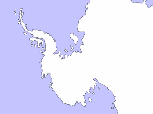
West Antarctica
Current Map of Habitable Zone 4


Remove these ads. Join the Worldbuilders Guild


I haven't seen a setting in West Antarctica before, very cool! What do the local people eat to survive, and how is it sustainable?
Check out my summercamp by going here and checking out any of my gold-star articles!
Thanks! Climate change had a great effect on the area, so animals such as cows and pigs can easily survive in the area. There is also a lot of fish to eat, as it's near the ocean. Water is obtained either from lakes uncovered by the ice melting, or from the deposits of ice that can be found in East Antarctica.
That's awesome. You know, I've never looked but are there maps of what solid land there is under the shelf? In Consternation are there still areas with ice shelf or is it all gone? It would be really cool to see another layer on your map which shows the historical state of the area so us modern readers can appreciate how much the ice has receded.
Check out my summercamp by going here and checking out any of my gold-star articles!
In Consternation, the ice sheets are entirely gone. The best map of what's under the ice is one compiled by British Antarctic Survey (https://goo.gl/C3KXnk) That's a good idea about the layer, I'll look into it - thanks